
The Western Aleutian Wave Exploration was an ambitious plan to explore this unknown region between Alaska and Russia. The below movie, article and photos try to depict what happened.
As our boat slammed into the growing & confused seas, heightened by the short period swell from the Bering, I could see a few of us becoming less talkative and less cheerful.
At that moment we still had a bit of pride and energy to fight the increasingly horrible feeling of nauseousness. But it was not long until we turned completely green and staying on deck breathing cold air, getting sprayed by 9-degree sea water felt like the only way to avoid the unavoidable.
—
This could have been a good introduction to the story, but I don’t think it would have convinced you of such a magical trip.
So, I decided on the below instead.
—
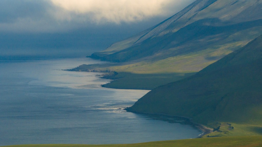
I suspect most surfers spend time looking at world maps, daydreaming about unexplored archipelagos. I certainly do. I’m not quite sure why, but I had never looked at the stretch of islands linking Alaska to Russia at the top of the Pacific Ocean. We’d done some trips on the east side of this region over the years, close to the Alaskan peninsula, but not the remaining 1,000 miles to the west, where 30 uninhabited islands lay in an area that Author Corey Ford described as ‘where the sea breaks its back’.
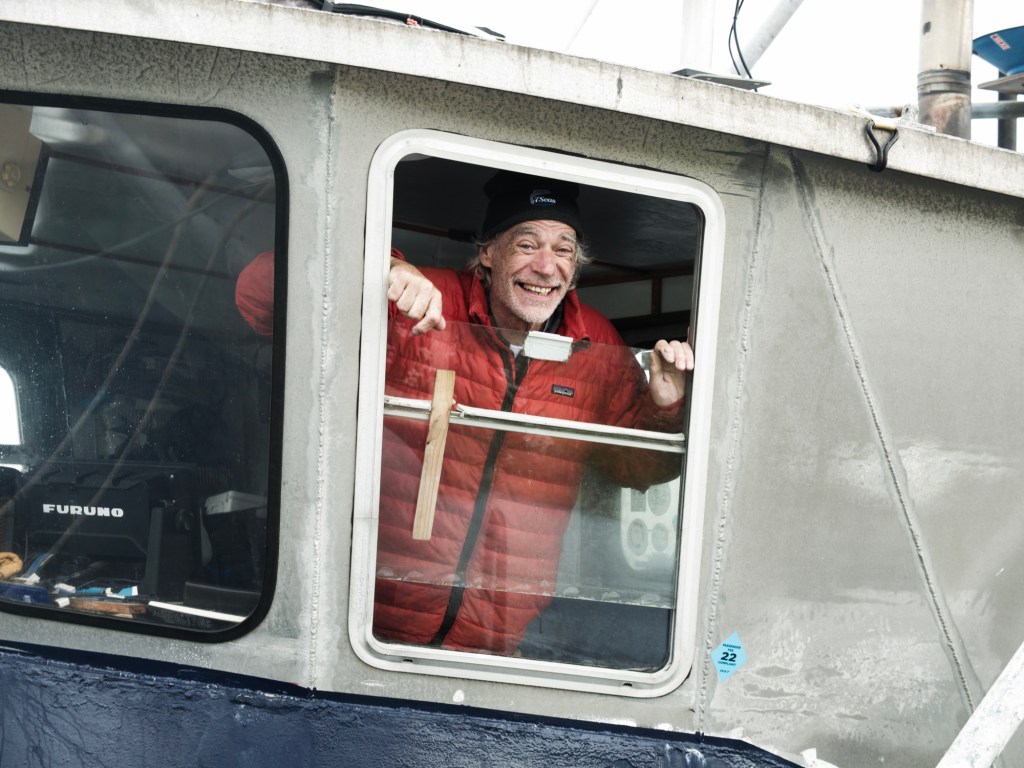
In August 2022, however, Mark Renneker (Doc as he is often called) sent me an email saying that our Alaskan friends, Captain Mike and Scott Reierson, were looking to attempt a run all the way to Attu Island. Possibly the most brutal stretch of the Pacific Ocean. Doc was looking for a small group of sea-worthy individuals to join him. At that point I was hoping he hadn’t overestimated me.
It was to be a historical trip in their words, never done before for the purpose of searching for waves, and rarely for any other purpose either. Doc felt it was as significant as his surf expedition to Antarctica in 2000. There was no way that we would take the chance to go in the “swell” season as it is simply something you cannot do. Unless for summer, the seas are impassable. The subpolar climate of the area is responsible for generating the northern hemisphere swells for all of the Americas.
I had previously seen such swells on a winter surfing trip to Petropavlosk-Kamchatski in the far east of Russia. When I arrived, the surf was 20ft+. And that was before the storm intensified and the whole town was locked inside for 4 days! So, imagine being on a 58ft converted fishing boat in such conditions. To further illustrate my point, the anemometer at Adak Island had been broken by the wind in such a season. It stopped working on a day that brought winds of 120 knots (222 km/hr).
I felt honoured to be invited by Doc, but at the time I had already committed to a few too many trips, so I declined the offer. However, Laura, my partner helped me realise that it just wasn’t to be missed. I went back to Doc and said count me in! And I’m so glad I did.
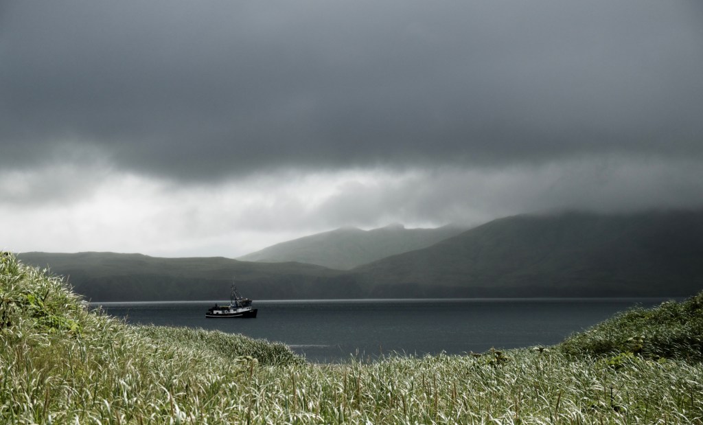
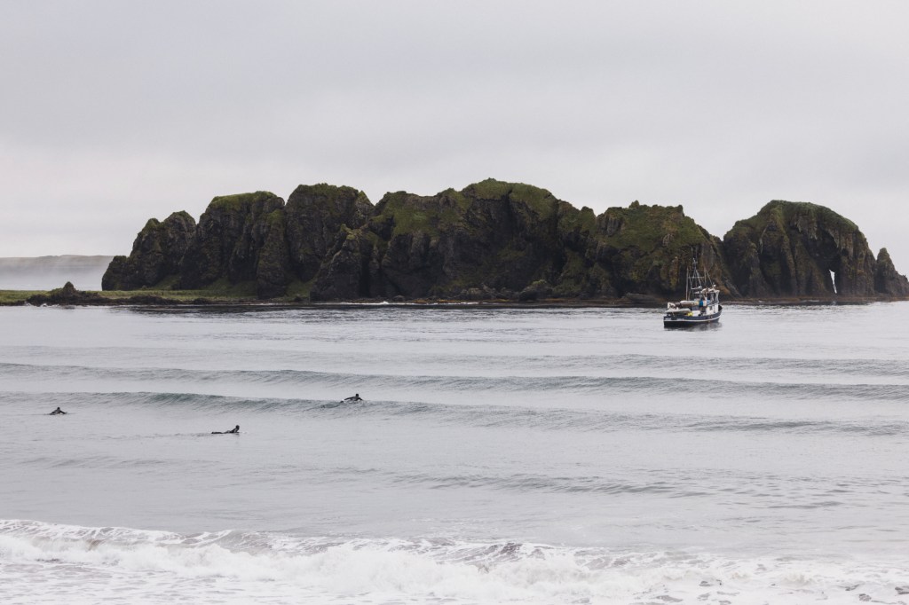
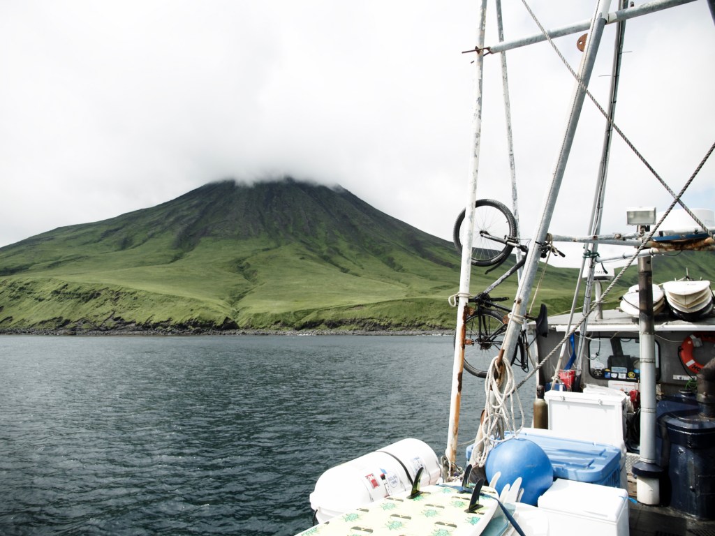
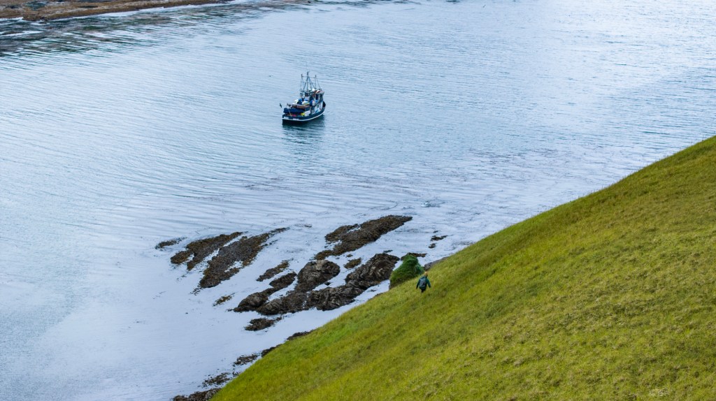
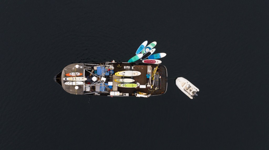
It was quite a serious undertaking that required more research and planning than the usual Alaska trips. Simple details like getting insurance for both the crew and the boat was a challenge due to the remoteness and notoriously rough seas. The converted fishing boat called the Milo that we would go on had to be modified for the 1700-mile journey.
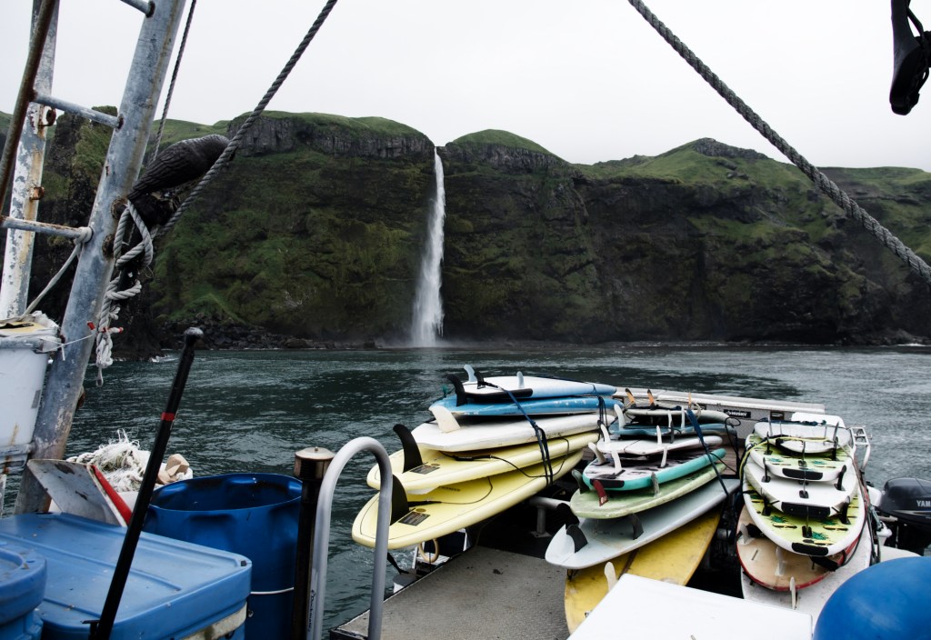
Everybody in our crew was quite clear that it was going to be challenging and a one-off expedition. The fuel cost alone was in the 10s of thousands of dollars, and the required 26 days of travel in close quarters on a small boat with 20 smelly wetsuits, was a bit beyond our comfort zones. Even the logistics of having food wasn’t simple. Wendy, our chef extraordinaire on the boat, got me to fly with 16 large boxes of food from Anchorage… and that was just a top-up on supplies already on the boat. Water reserves had to be managed carefully and improvising some ingenious system to pump water from a waterfall into our tanks made for a very fun mission on one of the two sunny days we enjoyed.
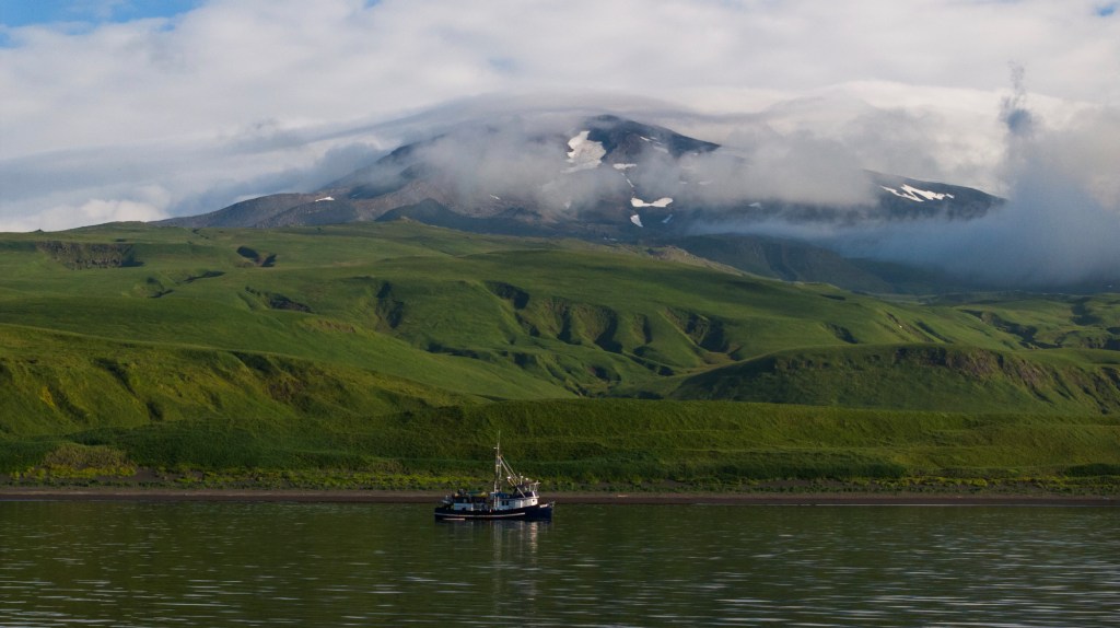
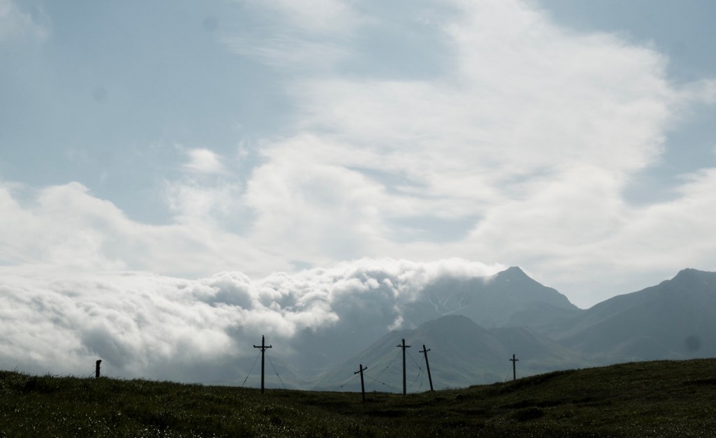
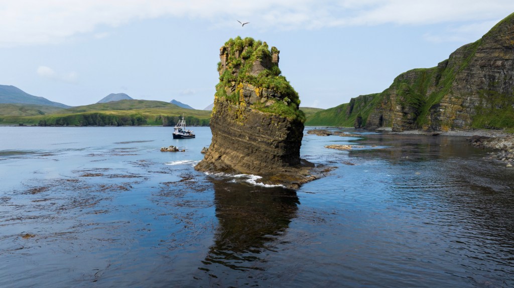
The journey, on a boat averaging 7 knots per hour was full of unknowns and meant that reaching our goal of Attu Island was highly doubtful: we had 12 lengthy traverses to make (sometimes up to 20 travel-hours at a time) with nowhere to shelter, where we would be fully exposed to the force of the Pacific and the Bering, and totally “un-rescuable” due to the distance. The currents could be extreme: at times we were down to 4 knots, and at others we peaked at 15 knots in a narrow pass with water whirlpooling around us. This was not that exciting for our Alaska friends, but I thought it was pretty remarkable. Parts of these areas were uncharted, and other parts were marked as being dangerous with the presence of unexploded ordnance from WW2. The fog was another unusual parameter: it rarely lifts in “summer”, despite the near-incessant winds. Throughout my research I read that during the war, flying weather was classed as suitable as long as you could see your co-pilot! We were lucky: we had lots of fog, but only once was it so thick that we couldn’t move for a day. And the wind was reasonable too. The region is often called the birthplace of the wind and our friend Pete who slept in the wheelhouse never slept that well due to the continuous whistling… but during daylight we enjoyed some manageable conditions. However, it was the wind that delayed our final departure at the end of our journey, meaning an extra four days on Adak Island. On the morning of our eventual departure, it was still blowing 43 knots (79km/h).
Covering such distances, motoring for close to 10h a day on average, meant that every liveable area of our boat became the scene of some funny shenanigans! First the stern. Pete and I had proudly announced on day one that we had never been seasick. Pete being Alaskan, and accustomed to Milo trips, means that he has some serious built in resilience. Well, 5 hours into the trip, he was projectile vomiting off the stern, alongside me, our pride soon to be a mid-arvo meal for the fish. Then we have Miss Peggy, which is the recycled wheelhouse that Mike welded on the back of the boat for additional living space. This is where the Boggle wars took place between Doc and Sarah Lee the awesome photographer , while Robbo and Bob spent time working on various scientific or medical papers. All of this to the tune of Pete writing songs that revolved mostly around taking the Mickey out of us, mostly the SUP’ers!. It is also where Bob would sleep to prevent the crew falling victim to snoring-induced insomnia. He would also have naps in what Pete called the bin down below: a rather small and uncomfortable compartment of the wetsuit drying area where all our bags were thrown in. He simply laid on top of it all and fell asleep being soothed by the incessant hum of the engine.
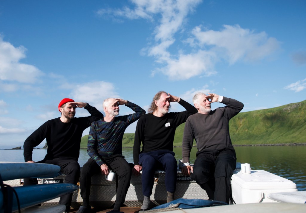
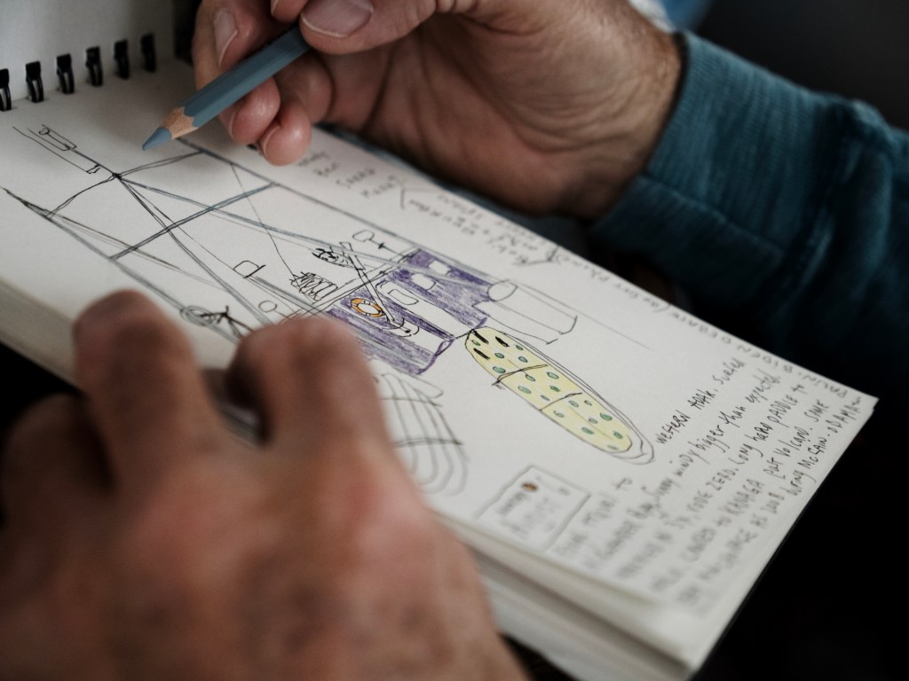
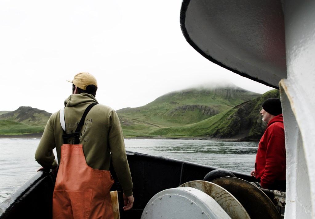
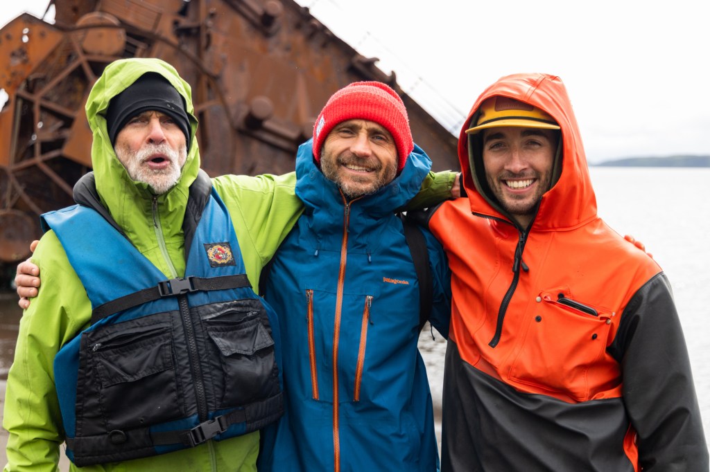
Up top, the wheelhouse is where debates took place, mostly on what our best strategy should be to find waves on the next island. Binoculars were shared around like a joint at a college party. I spent time studying the face of my teammates, and how they interact. Their experience in such expeditions around the globe, their successful and varied careers in law, photography, neurology, engineering, and a few years on me, made for such interesting characters to take in. But who I observed most is Captain Mike. As I looked at him hiding behind his yellow binoculars, I thought about how much responsibility he held. It felt like our lives truly were in his hands. Anxiety and fear were words that came up several times on the trip, mostly appeased by our full trust in his mastery.
The galley, at the centre of the boat, where Wendy regularly cooked at 45% angle, was where memories were shared, and music was played. Mostly, it is where we kept paying each other out, and where tears of laughter were a daily thing. I kept having to remind myself that these guys are not in their thirties. They act, move, travel and surf like they are. They were, however, all born in the 50’s and still surfing Maverick! Listening to their skateboarding antics of the 60’s, their search for surf in the most random places like Greenland or Svalbard, or their fascinating careers (Pete won the multi-billion dollar Exxon-Valdez court case, which isn’t small!), reminded me that whilst I am in my early 40s, this is just the start for me!
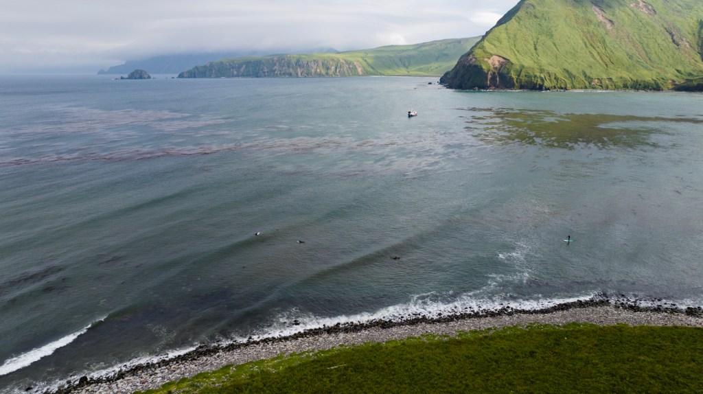
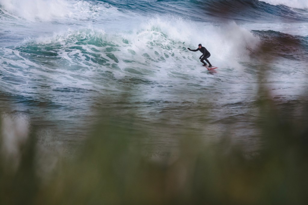
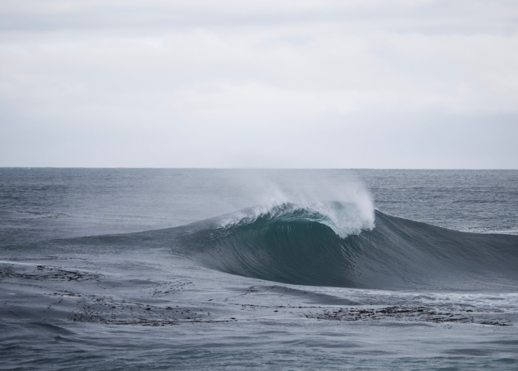
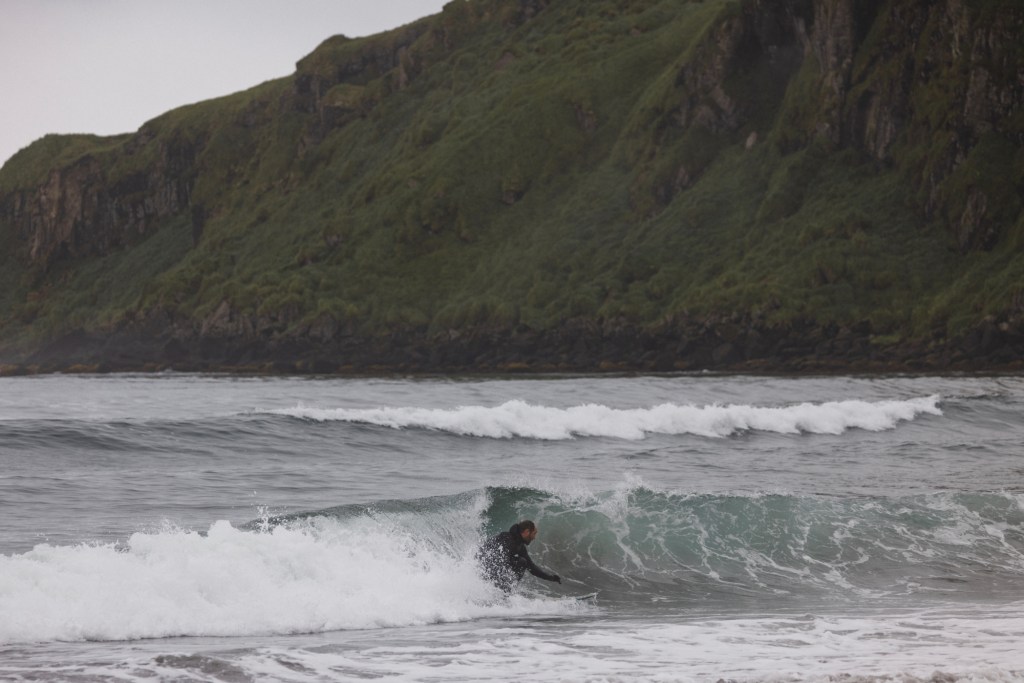
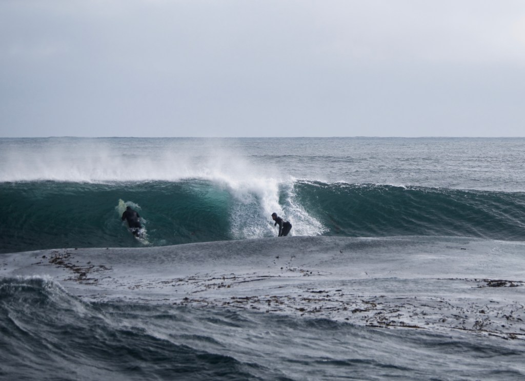
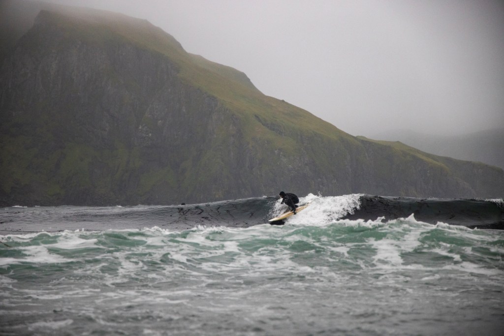
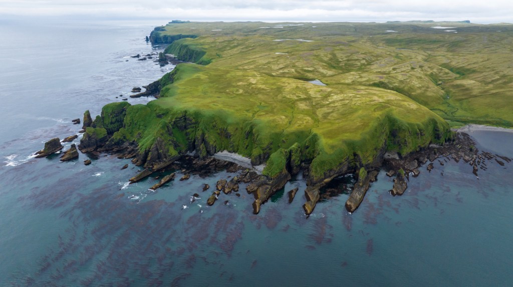
Out of the 30 mostly volcanic islands of the area, we searched around 15. We had the luxury of having both the Pacific and the Bering Sea generating small swells on each side of the island chain. We had done our homework: Bob Batalio, the coastal engineer on our crew, had the scientific understanding of what was needed to find surfable waves. His passion and career revolve around geomorphology and dealing with rising sea level. Worth noting here that his method to deal with this is to give space to nature. I loved that. His experience and access to interesting and rather detailed maps, mixed with the simplistic Google Earth approach, meant that we had earmarked tons of potential spots. Of the ones we could access, 20 turned out surfable, although mostly small at the time.
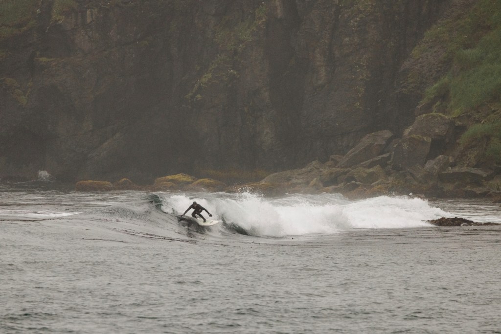
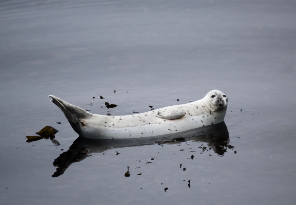
Despite having found mostly small waves, the satisfaction, and sense of accomplishment among the crew was remarkable. They come on these trips with their 10ft guns, ready to surf anything, but are equally happy finding a waist-high peeler with a backdrop of Puffins frolicking on giant green cliffs, with a few otters or Steller sea lions visiting the line up. As Doc said, “wouldn’t you be happy to surf a mushy wave on the moon, well this isn’t too different”. I agree with him, but I could happily do without the thick kelp which sometimes forced us to either go finless, leash-less or miss 60% of the wave due to being entangled on take-off. It made for some serious laughter!
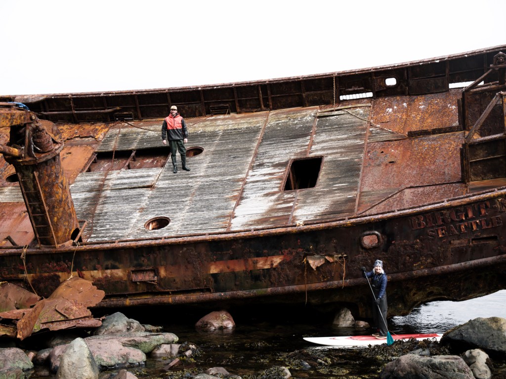
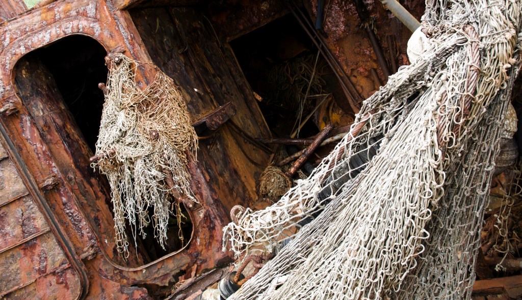
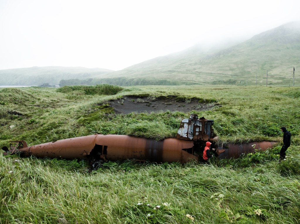
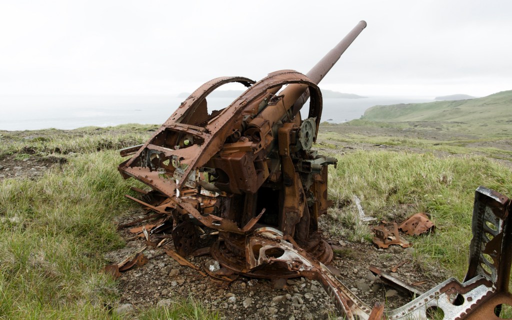
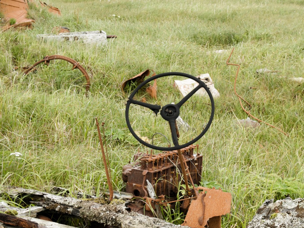
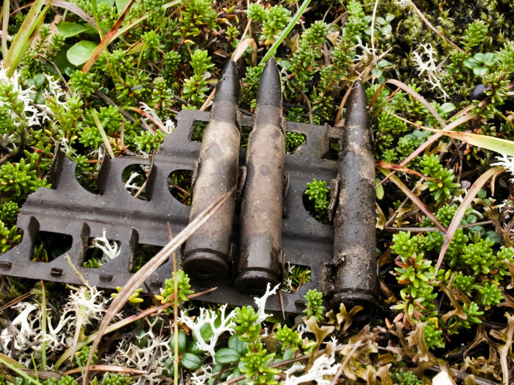
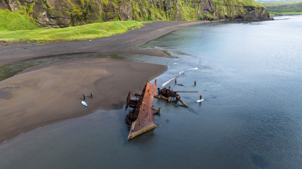
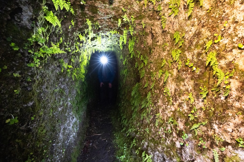
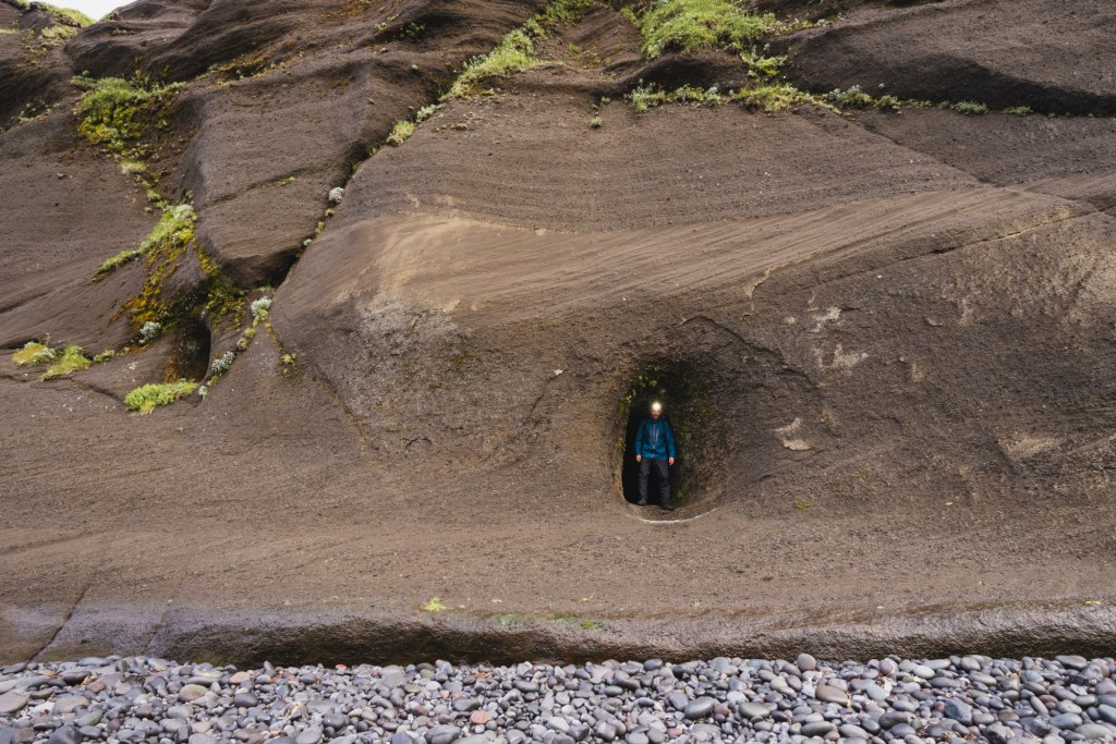
Most research I had done revolved around what I would call a mix of light anthropology and history of the area. The more I read the more I understood why large sections of the nautical charts I had found were labelled with unexploded ordnance annotation. In the early 40s, at a time when the US was seen as having significant world domination, Japan embarked on a plan to change the world order, all while Hitler and Mussolini were causing havoc in Europe. Part of the plan was to take over a large chunk of Asia, as well as the US. The invasion of the latter started on Attu Island and Kiska Island, the last islands before entering Russian waters. They had enjoyed a great run of terrorising and demolishing their enemies, but they under-estimated the weather conditions of the Western Aleutians. Literally thousands of boats, planes and submarines were used during the gruelling battles where soldiers often died from weather-related conditions rather than artillery-inflicted wounds. Out of the total 500,000 Japanese, American and Canadian soldiers, close to 10,000 lost their lives. Having such battlefields as the backdrop of our seemingly meaningless search was unusual. Hundreds of visible craters disfigured these islands, as well as man-made caves, bunkers, rusted cannons, guns, ammunition, shipwrecks, demolished barracks and even a destroyed submarine and plane were just there, in plain sight. It seemed crazy that such deadly battles didn’t yield prizes for the winner: the place was empty and desolate. Trees can’t even grow there.
Prior to this, Aleuts (the native Inuits of the region), had inhabited these islands for thousands of years thriving amongst the harshest of conditions. It was even a time when the Baidarka was invented (more commonly known as the Kayak). This was until Russian fox and seal hunters decimated the Aleut population during the fur trading era of the 1800’s. And in 1942 the few surviving Aleuts were taken prisoner of war by the Japanese.
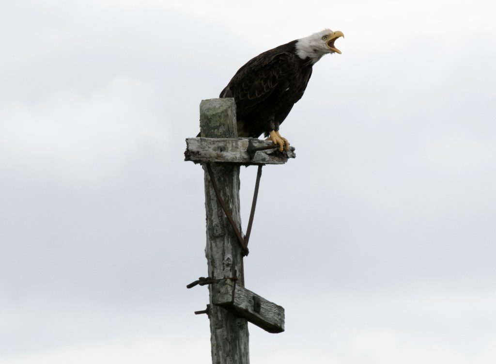
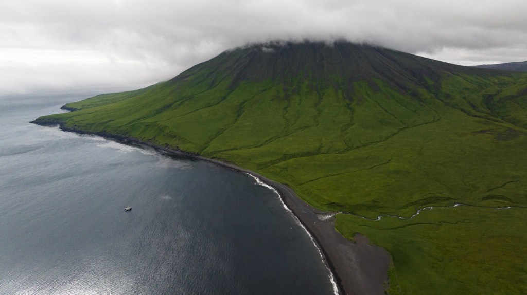
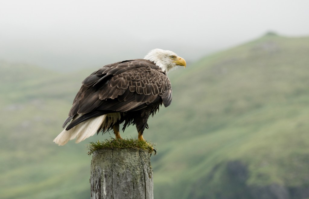
Today nothing remains in the Western Aleutians, but nature is taking over. Literally millions of Puffins, Albatross, Petrels, Auklets and other birds are enjoying what looks like the least visited place on Planet Earth. Even the sites of three atomic bomb tests from the 60’s on an island called Amchitka, are seemingly flourishing with colourful tundra as if nothing happened.
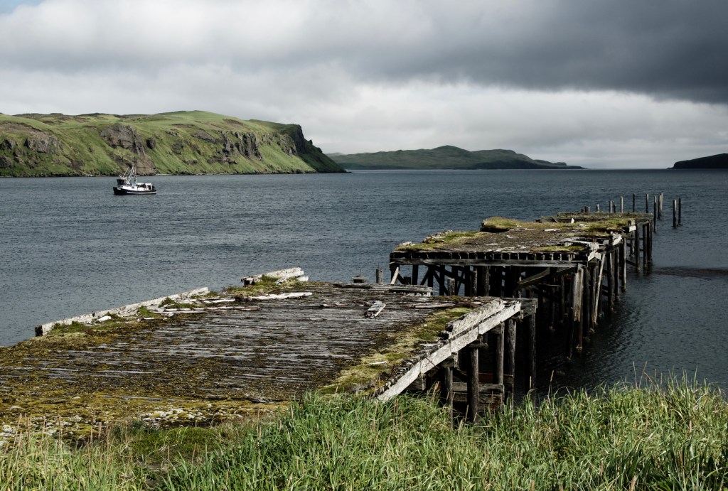
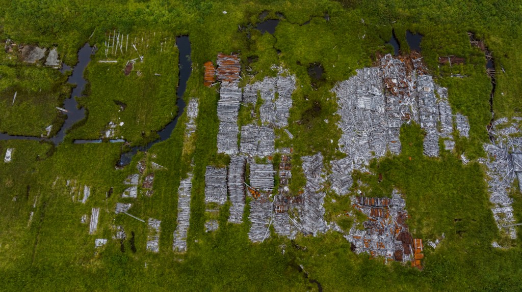
We finished our journey where we started, on Adak Island, a place where 90,000 army personnel were posted in the 40s, and where a whole town was built during the Cold War, only to be abandoned 30 years ago. It is hard to feel happy in a place, where you can easily draw parallels to what we are doing to the whole planet. We spent hours walking through abandoned houses, barracks, nuclear missile launch pads, indoor swimming pools, a McDonald’s restaurant, a hospital and even a bunker full of beds. All destroyed by the wind, and all left for another generation to clean up. We surfed some good size waves though, at a place called Gitmo, with an abandoned ammunition storage building as our marker, and a majestic volcano in the background. Surfing brings joy no matter where you are!
I wonder if such stories reinforce my Mentawais-going fellow surfers’ feelings that cold water destinations are a silly idea. After all, the only guarantee when going into such inhospitable regions is that one will get ice cream headaches. Or does it help them understand why some surfers spend their life going there! For me, such trips generate such memorable moments that go far beyond the surf.
I still remember the feeling of receiving Doc’s invite, and the subsequent long winter-months reading all the books I could find on this region. That alone is memorable.


T’es balèze mon cousin !!
Je vais souvent sur Google Earth voir les choses d’en haut, les îles que tu as visitées sont impressionnantes, assez effrayantes de part leur histoire et leur coté inhospitalier !
Je te souhaite encore de très belles aventures !
Fred
LikeLike